| |
Inyo County Goes After Death Valley
In October 2006, as
San Bernardino filed its suit to take over routes in the Mohave
Preserve, its neighbor, Inyo County filed a suit of its own. Inyo’s
suit seeks to open three routes inside designated wilderness in the
lower 48’s largest national Park: Death Valley.
The complaint includes maps of the claims.
Inyo County
trumpets its suit on its website, which includes conflicting maps,
descriptions of each route, and minutes of county meetings.
What resources are
at stake?
See an
overview map.
-- Greenwater
Canyon. The County seeks to open one route through Greenwater Canyon,
which contains significant Indian rock art (petroglyphs).
See a map of
the route.
-- Greenwater Valley,
to the south of Greenwater Canyon, was previously (and illegally)
bulldozed by Inyo County. Conservation groups protested the
action in a 2004 letter. The Park Service partially re-vegetated the
route shortly after the bulldozing.
Read
a spring 2004 Sierra Club newsletter about Inyo County’s
bulldozing and the Park Service’s efforts to recover the area.
See a map of
the route.
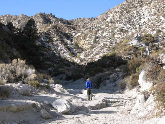
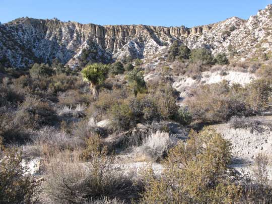
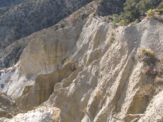
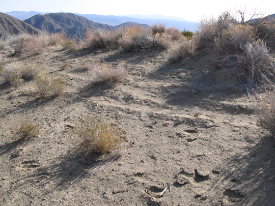
-- Last Chance
Canyon. A third route drops down a large, nearly vertical cliff in
Last Chance Canyon.
See a map of the route. See photos from a recent visit to the
route (at right).
Click on
photos for larger versions
→
January 18, 2007:
Conservation groups move to join the suit to defend public lands.
Read their
press release and their
motion to intervene, which explains why opening these routes to
vehicles would degrade the Park. The media also picked up the story –
see an AP story
from January 18, 2007.
Read a lively
discussion about the impact of Inyo County’s suit in a
blog about National Park Service issues.
Learn
more about Death Valley National Park – the largest national park
in the lower 48 states.
Summer 2007: A federal
district court judge ordered that
conservation groups must be included in Death Valley suit, a huge
victory for our public lands.
|

A hiker in Last Chance
Canyon. Inyo County seeks the right to turn this canyon into a
two-lane highway. All
photos ©
Tom Budlong, 2007, used with permission.

The
wall at the headwaters of Last Chance Canyon. Inyo County claims
a two lane highway should descend this ridge.

The same ridge from on top.

A two-lane
highway? |