| |
Conservationists Criticize BLM Plan to Surrender "Bald Knoll" Road to
Kane County, Utah
On October 30, 2007,
conservation groups asked the Bureau of Land Management (BLM) to deny
a Utah county’s attempt to take control of a rough, rarely maintained
route on federal lands under the repealed law known as R.S. 2477.
Read their letter.
This is a
first-in-the-nation test of a controversial
policy hastily
issued by former Interior Secretary Gale Norton just days before she
left office.
Rewarding a Bad Apple.
BLM is proposing to surrender control of the route, known as the
"Bald Knoll" road, to
Kane County – the same county that ripped down federal road signs
in the Grand Staircase Escalante National Monument in 2003. Then, in
2005, the Kane County illegally posted road signs in areas the BLM
closed to damaging off-highway vehicle use including sensitive
wildlife habitat in the Monument.
At the time, BLM’s state
director, Sally Wisely, demanded that the County remove its signs
because they "likely present serious safety issues to members of the
public, possibly subject them to legal exposure, and cause resource
damage."
Read her letter.
In the
letter delivered to BLM today, conservationists criticized BLM for
essentially rewarding Kane County for its past bad behavior by
proposing to give away a route without taking action to protect the
Monument and other federal public lands.
Where’s
the Evidence?
Conservationists
emphasize that even under the relaxed standards of the Norton policy,
the application submitted by Kane County fails to supply the required
evidence to show the route was constructed under R.S. 2477.
Kane County failed to
submit, and BLM failed to look for, easily obtainable evidence that
undermines a finding that the route was an established right-of-way in
1976, the year R.S. 2477 was repealed.
The information –
including aerial photos, Kane County maps, Utah maps, and even BLM
maps – fails to show the entirety of the route existed before then.
The evidence includes:
1960 aerial photos that
don’t show a significant portion of the route.
Read an analysis of the photos;
County highway maps from
1950 and
1961 that show none of the route;
County highway maps from
1977 and 2006 that don’t show the entire route;
A
BLM map from the 1970s that doesn't show the route;
A
letter from Kane County admitting that it doesn’t have any files
that indicate it maintained or constructed the Bald Knoll route
before October 21, 1976 (read the
conservation groups' letter requesting information); and
BLM files that show fence construction proposed to cross the
claimed route at two locations in the 1950s, but don’t show the road
or a cattleguard where the road should be.
If BLM makes a "non-binding determination" (NBD) that a
right-of-way exists based on this type of evidence, millions of acres
of public lands will be subject to weakened protections from industry,
ORV groups and other private interests. |

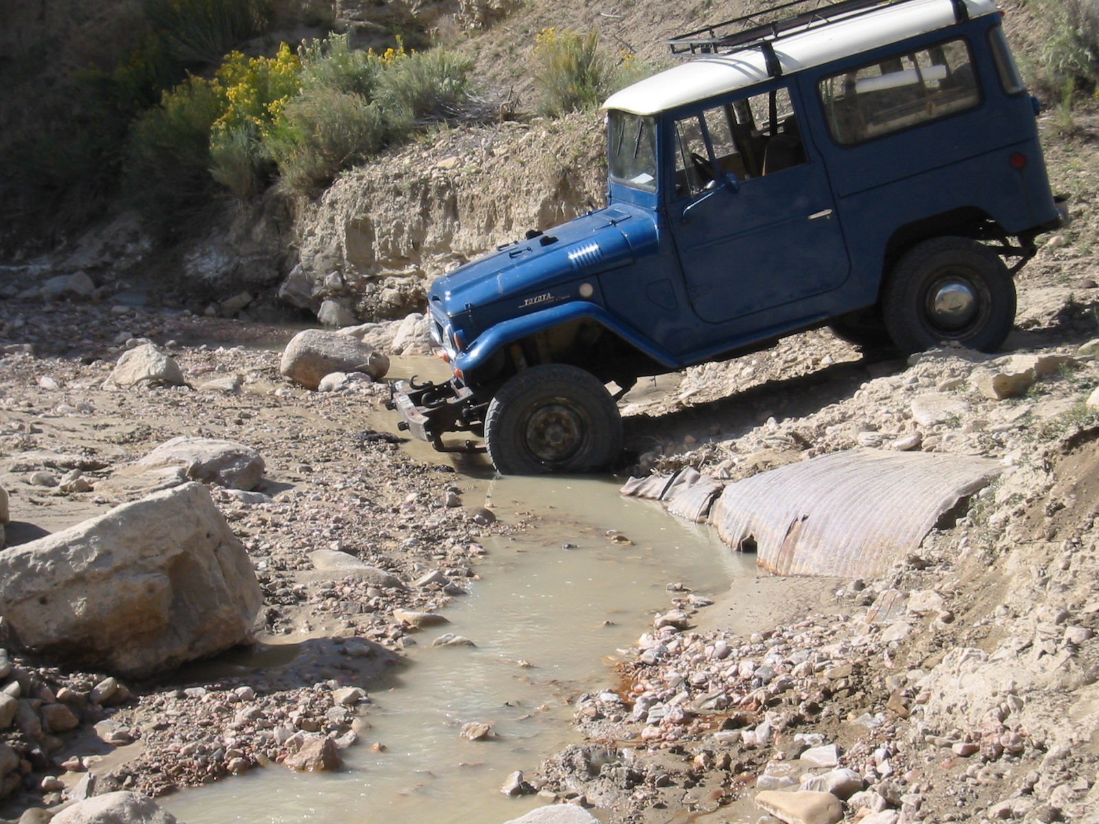
The Bald Knoll "highway."
(Click image to view larger).
Photo used with permission. Copyright (c)
2007Jim Catlin.

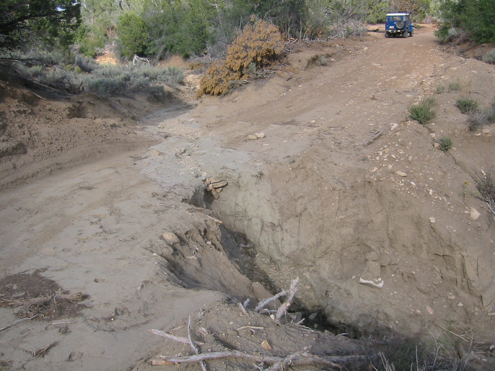
Erosion eating away at Kane County's "maintained" route.
(Click image to view larger).
Photo used with permission. Copyright (c)
2007Jim Catlin. IN THE NEWS!
Read an October 31, 2007
Deseret News article and
a press release to learn more about what conservation groups are
doing about the BLM's NBD. |